Clava Cairns, Inverness
Stones of Wonder
QUICK LINKS ...
HOME PAGE
INTRODUCTION
WATCHING
THE SUN, MOON AND STARS
THE
MONUMENTS
THE
PEOPLE AND THE SKY
BACKGROUND
ARCHAEOASTRONOMY
USING
THE SITE DESCRIPTION PAGES
VISITING
THE SITES
THE
LEY LINE MYSTERY
THE
SITES
ARGYLL
AND ARRAN
MID
AND SOUTH SCOTLAND
NORTH
AND NORTH-EAST SCOTLAND
WESTERN
ISLES AND MULL
Data
DATES
OF EQUINOXES AND SOLSTICES, 1997 to 2030 AD
DATES
OF MIDSUMMER AND MIDWINTER FULL MOONS, 1997 to 2030 AD
POSTSCRIPT
Individual
Site References
Bibliography
Links
to other relevant pages
Contact
me at : rpollock456@gmail.com
Chambered cairns, Ring cairn NH 75729 44425*
 How
to find : The cairns are six km east of Inverness,
and signposted off the B9006 just east of Culloden battlefield. The site is in state care, and
beautifully situated in a small open wood.
Best time of year to visit : Winter solstice about December 22nd to see the sunset down the line of the cairn entrance passages. Or any time of year to enjoy a genuinely atmospheric place.
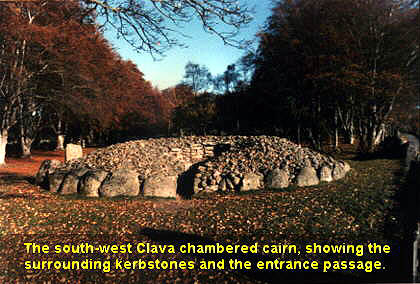
Peaceful and inspiring, the Clava cairns have an atmosphere all of their own. When the author took parties on tours of archaeological and historic sites in the Highlands, this site was usually the visitors' favourite. These cairns at Balnuaran of Clava give their name to a set of thirty monuments which are distributed up and down the rivers around Inverness. There are two types of Clava cairn, ring cairns, which are a ring of loose stones with kerbing inside and out, and chambered cairns, which have an access passage into the central area. Both types have circles of standing stones around them. All the cairns, including the ones here at Clava itself, have been robbed of some of their covering of stones. The chambered cairns would originally have had corbelled roofs, and the central chambers would therefore have been enclosed. Try to imagine being inside the small chamber in the darkness and silence and cold at midwinter.

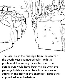
There are several groups of cupmarks pecked into the stones of the three monuments here. They occur in the passages of the chambered cairns, and on one of the internal kerbstones of the south-west chambered cairn. The best preserved group are on the northernmost stone of the outer kerb of the north-east chambered cairn. Two of the kerbstones on the east side of the outer kerb of the ring cairn are also cupmarked.
Excavations have established that the monumnets were built in the Early Bronze Age, about 2000BC. (Full report is available here.)
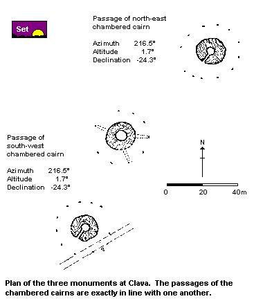
It had long been noticed that the stones of the surrounding circles were graded in height, with the largest being in the south-west. The inner and outer kerbstones of all these type of monuments are also graded this way. The passages of the two chambered cairns here, as can be seen on the plan, also point to the south-west. It is worth remembering that the only way this direction can have been consistently established in a prehistoric community in the days before the magnetic compass was by reference to the stars or to the sun at midwinter. The two cairn passages here indicate the setting point of the sun about the shortest day of the year. In the local area the cairns of Clava are well known for their orientated passages. The discovery of the midwinter lines was made about eighty years ago by Boyle Somerville when he first planned the whole site.
The traditional interpretation of such sites has been as communal burial chambers for the dead, and such an idea seems to fit well with the dead time of the sun the cairns unequivocally indicate. However, there is a lack of substantial burial evidence from such excavations as have been done, and the cairns may equally well have served as focuses for tribal midwinter rituals which are now lost, except in our imagination.

Return to North and North-east Scotland index
Return to Stones
of Wonder opening page